

Dumfries and Galloway
Dumfries & Galloway, 380 miles of adventure awaits… The South West of Scotland is probably a little overlooked when heading to Scotland on a bikepacking adventure. Everyone heads up to the highlands, and while that’s always a good choice, you are missing out of some amazing fun to be had around Dumfries and Galloway. I had a big empty space on my route map that needed filling so I decided to put together this epic 380 mile bikepacking loop around Galloway (a little Ayrshire too).

Scotland/England Boarder

Joe Graham’s Monument commemorates a local master of fox-hounds who died in 1893, aged 80.
This route starts and finishes at the boarder of Scotland and England in the first village in Scotland, and it's most famous for weddings. After the 1754 Marriage Act, couples under twenty-one couldn't marry in England or Wales without their parents' consent. But it was still legal in Scotland. So couples began crossing the border into Scotland to tie the knot. Assuming you are not eloping and are here for a bikepacking adventure though the route starts off fairly easy with the first 10/15 miles or so mostly paved. It’s not really until you get to the first set of hills that you start to go off-road. This route it does use some roads from time to time but it is for the most part off-road and the first of road section you will head up to, Joe Graham’s Monument. If you are coming from the south to start this route then you will likely have been travelling most of the day, so this is a good place to set up camp around this area before heading across some grassy fields, some of which a little hard to ride and over grown towards Dumfries.
Leaving Dumfries, which is the biggest of the built-up places around this area so it’s a good spot to make sure you have everything you need for your adventure. You will be heading out into the forest tracks with views over the Nith Estuary, on a clear day when you get a break from the trees you can get good views over towards the lake district. Unfortunately for me, it was extremely wet this day and foggy so no such views for me. Which brings me onto something you probably don’t need reminding but bring a very good waterproof jacket as it will probably rain at least once while you make it around this Galloway route.
The Coast
There is a section of coastal paths that I have added onto this route which should be noted that you will need to be able to lift your bike over a couple of gates. A couple of kissing gates just before you get onto this section. This section is very beautiful. But might be worth avoiding in the busier months as the trail is narrow and a little hard to ride in places. If you want to cut this section out then just follow the road through Auchencairn. But I think it’s worth the visit if you can.
After some more gravel tracks with panoramic views and of course climbing the next places you will visit is Kirkcudbright, pronounced (kirk-coo-Bree) apparently. It is a beautiful little town. Known as an artist town because visitors come to draw and paint the charming harbour and quaint buildings. And if you can time it to arrive here early in the morning as the sun is rising it’s a great spot for some breakfast. Following the river Dee out of the town will give you a nice rest bite as it’s fairly flat for a few miles, which you will want to enjoy as there are a couple of steep hills incoming, one of which starts off with a short hike a bike. Short and steep mind. But once you get to the top you have loads of gravel tracks to enjoy for the coming miles. They are nice but can be pretty tiring of course so make sure to bring your easy gears.
Cree town - Loch Ryan
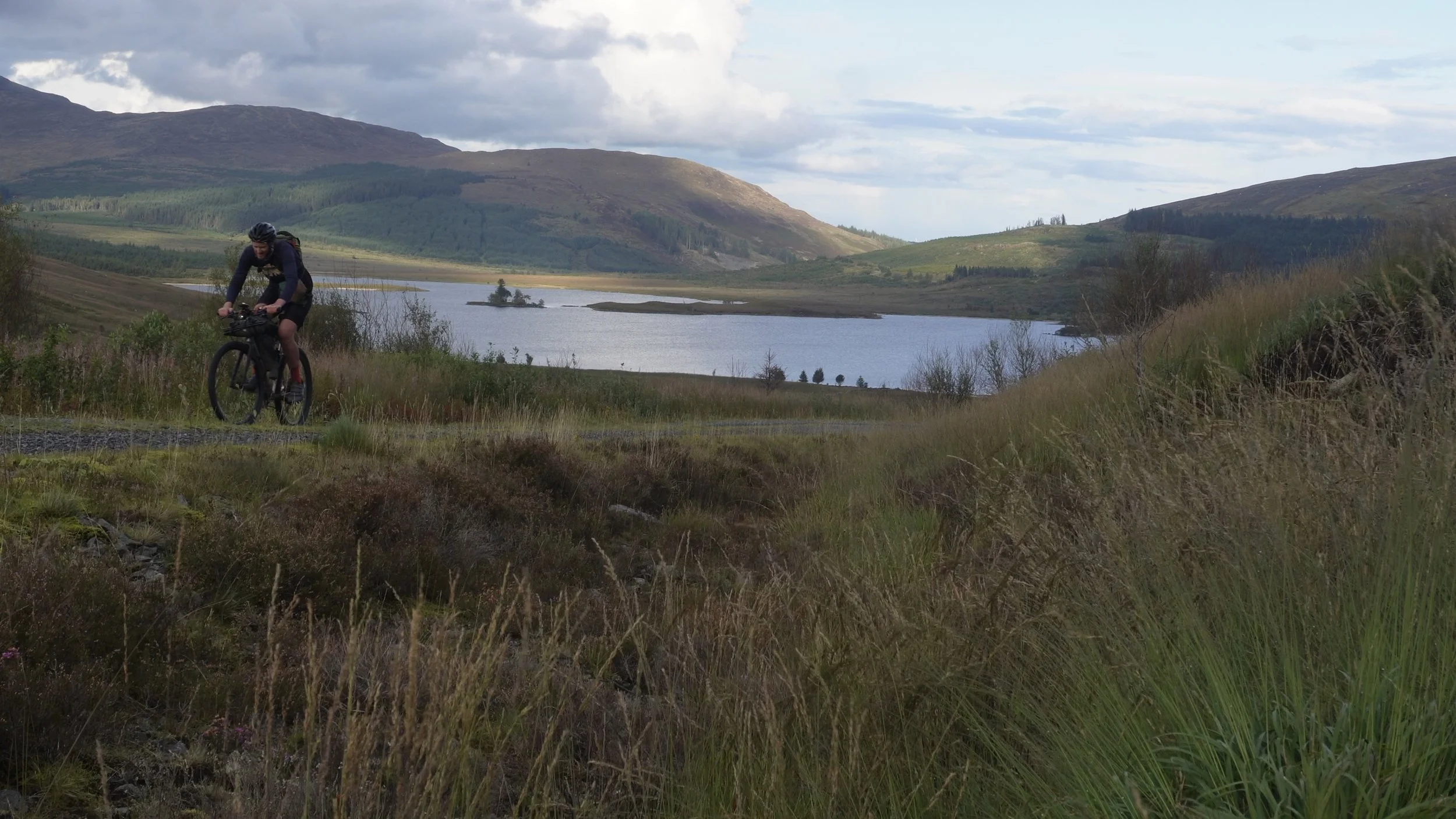
Probably one of my favourite stretches on this route full of absolutely epic views not very technical riding but some good lung busting tracks. And there is a bothy at loch Dee so might be a good spot to aim for the night as this route isn’t always the easiest to find actual camp spots. Often being on forest tracks means good ground is few and far between. The bothy at loch Dee (White Laggan Bothy) is quite easy to spot in the direction I have routed this route. As you descend (mile 145) on the Komoot map, it will be just a short hike to your left.
This section of the route though is really beautiful. With the likes of Black Loch with Castle Kennedy, a mansion house built in 1607. Arriving at Loch Ryan this massive sea loch stretches about eight miles long and three miles wide, providing a natural sheltered anchorage in southwest Scotland. It's the main gateway between Scotland and Northern Ireland. So if you want to pop over to Northern Ireland then the ferry is just there for you.
Technically you do leave Galloway here for a little bit as you head up the coast and into Ayrshire to Ballantrae. Another beautiful little village with a couple shops for a resupply point. The road before you turn off onto the coastal path can be quite busy and fast here especially if the ferry has just arrived. Ride safe. That interesting looking rock in the distance is none other than Ailsa Craig The name Ailsa Craig is thought to derive from Gaelic words meaning “Fairy Rock.” it rises steeply to an elevation of 1,114 feet and Its rock has been used to make curling stones. Formed from a volcanic plug from a long extinct volcano believed to be over 500 million years old.
When you leave Ballantrae then the route from here does get progressively harder as you head up into the hills. I did make it a bit easier in the end for this final version of the route. I had initially planned to go to some even harder to reach places but it would have been too much hike a bike. So more the most part the climbing is all rideable it’s just long and can feel like you are going up for a while. As you head towards loch Doon is where the longest hike a bike section is, it’s not unridable but it probably is a bit much for a gravel bike. Between Loch Braden and loch Doon is the part with the hike a bike. I was running out of time so I was hiking most of it as fast as I could and it probably takes about 1–2 hours depending on how much you can ride. It’s remote rugged beautiful but can be slow-going. This is where I had the issue though of fallen trees blocking the path at the end of the trail. Meaning I was left to try to scramble my way round in the dark. So if you are planning to ride this route as of 14/09/25 then this section is blocked off and I would either wait for a while and hopefully it will get cleared or i am going to put an alternative route down below. Loch Doon seemed to be a popular place with campers when I finally made it across to there.
The Last part
Hopefully you won’t have any issues like I did to get to loch Doon and you will be able to continue on with no problems, because after this section you have plenty of miles through gravel tracks and wind farms. When you arrive at Mennock you know you will have a very nice beautiful paved climb up to Scotland’s highest village. Wanlockhead, sitting at 1531 ft feet above sea level. The climb up here I found to be quite a mellow climb it is a longish climb but not overly steep. A couple little kicks but nothing compared to the next climb. From the Scotland’s highest village you will be going even higher up Lowther Hill this is another road climb, closed road most of the time as far as I can tell as it goes up to one of them radio tower things. There is a handy little weather shelter at the top of this hill called the lunch box it’s not really a bothy and not very big and is really meant as refuge from the weather which I’m sure you can imagine can get pretty bad up high. About 2000ft. But I did just sleep on the bench in here one night. Would struggle with more than one person though. But it’s good to know it’s there if you need shelter. The next 10–20 miles get pretty tough even though you will start to go downhill. The south Upland way here follows along the “top” of the hills, but that means going up and down an with a bike is pretty slow-going. The trails can be boggy and there is plenty of steep short hike a bike here. There is another bothy Brattleburn Bothy after you get over the hike a bike at Daer Water Reservoir. Can’t miss this one as there is a sign for it on the trail this route follows.
Lunch Box Weather Shelter

Lowther Hill
The only other thing really to note about this route is there are occasion where you need to make your way from one forest track to another this normally means a little hike sometimes steep and sometimes boggy. There is one I had to do that had not been kind of destroyed by the forest works. They were not working at the time I went through so I was able to follower their tracks down and back on course. I’m not entirely sure how that trail will change over time. But it is just before you leave the final forest towards Bowanhill.
Wild Camping
Being Scotland this is allowed but remember to still practice leaving no trace. The route wasn’t always the easiest to find somewhere to pitch the tent as the ground isn’t always great. But there are quite a few bothies around which you can make use of. I’d go with a tent and make sure you have a good bug net for midge season or just avoid that season. I took on this route in September and the midge had mostly all gone by that time. The route has some coastal section too so should reduce the midge a bit around there.
Which Bike
I took this on with a flat bar gravel bike with 50mm tyres and 38/46 easiest gearing and there were still times when that gearing wasn’t quite easy enough. The 50mm tyres were fine for most of the route, but there were a few sections where a MTB would have been nice. I think as long as it hasn’t been overly wet or you are taking this route on in the winter than a gravel bike is manageable for the most part. A lot of the trails are forest tracks after all. However, there are a lot of MTB trails around these forest tracks so if you wanted to have some fun on them a hardtail would make for some good fun too. Remember though you will need to pick the bike over a couple of gates here and there and hike over some steep terrain so make sure you can do that with which ever bike you choose.
Resupply points
The route does have some sections where resupply points are far a few between but as long as you can carry about one day worth of food you should be fine. The mains resupply points are…. Gretna, Dumfries, Dalbeattie, Kirkcudbright, Creetown, Ballantrae, New Cumnock, Sanquhar, Moffat, Langholm.
Public Transport
Being a loop means you can start wherever you like and there is a train station at Gretna Green if you want to get to the official start although I just cycled from Carlisle. Other places you could join the route are … Dumfries, Cairnryan Ferry Terminal (if you are coming from Northern Ireland), Stranraer, New Cumnock, Kirkconnel, Sanquhar.


